From a geographic perspective, Sugar Hill is uniquely situated. Our western border comprises the Chattahoochee River. Sugar Hill’s northern border is Lake Lanier. One was made by nature, and the other was made by man. The Chattahoochee River flows from its headwaters in the Appalachian Mountains of Georgia all the way to the Gulf of Mexico. The river and all its tributaries have helped shape and define the geography of our area for hundreds, if not thousands, of years. The hills of Sugar Hill and the valleys in between have been etched by flowing water. Our history as a community has been written by the activities of people along some of the Chattahoochee River’s tributaries, like Level Creek, Richland Creek and Crayfish Creek. Gold mining and moonshining were common along these creeks, and even in modern times, the evidence of these legal and illegal business activities is evident. The creation of Buford Dam and Lake Lanier did not alter the role these creeks and tributaries have played in both shaping our geography and the history of our community.
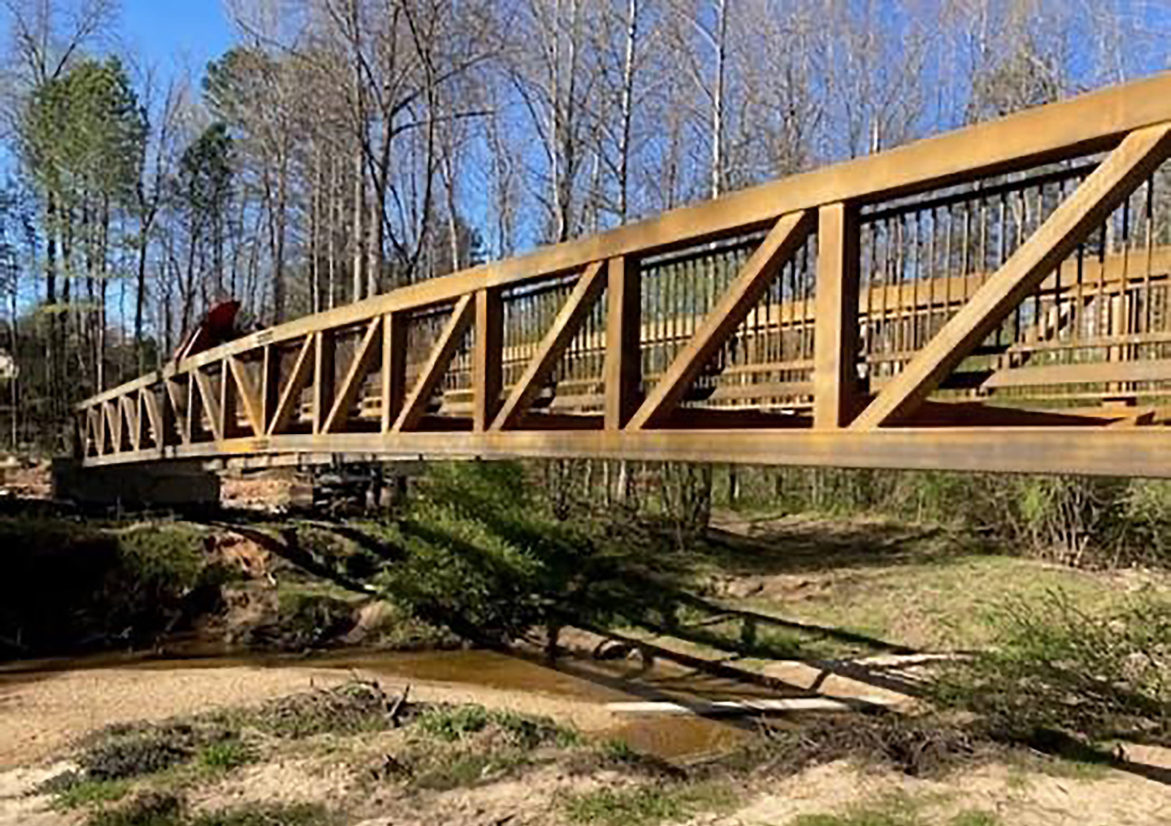
Level Creek, the most recognized of the tributaries in our history as a community, provided water for farms that were once prominent in Sugar Hill. The area now includes Level Creek Road and connects North Gwinnett High School to our community’s downtown area. The area has level ground, in comparison to most of Sugar Hill, and provided good soil for farming and later flat stretches of earth for railroad tracks on the eastern part of our community. Level Creek starts near First Avenue in the downtown area. Like most of Sugar Hill’s creeks, its source is mysterious and comes from an underground spring. Level Creek flows near the old and new E. E. Robinson Parks. Arrowheads and pottery shards found near the newer park suggest Native-American Indians lived or hunted nearby. The Shelley Family purchased a home near Level Creek in the 1880s and began gold mining operations in the area. Later, other individuals and families would farm and mine for gold in the area. In modern times, Level Creek flows through Gold Mine Park and near one of the old gold mines until it ultimately makes its way into the Chattahoochee River.
Richland Creek, the most iconic from a name perspective, has a history of both gold mining and moonshining. Our longest creek starts near Little Mill Road and Buford Dam Road and flows from its source through the northern part of Sugar Hill. Richland Creek is a prominent feature at Pirkle Park and, in recent years, has silted up and flooded the area around the park. Like its mysterious source, history suggests its name may have come from our community’s gold mining past. Native-American Indians or early settlers could have referred to the “rich land” in the area. Several years ago, a property owner living near Richland Creek discovered an old moonshine still that had axe marks, indicating that it had been found by law enforcement many years ago and busted up. Amateur gold panning is common along the creek, and old gold mines are still being discovered in the area around the creek. Richland Creek, as its name implies, has a very rich history.
Crayfish Creek is an old creek but new in name. Before Sugar Hill’s mayor and city council named it in 2021, it was an unnamed creek. It begins at a spring below Suwanee Dam Road and flows for about a mile until it makes its way into the Chattahoochee River. Baptisms were held by Riverside Baptist Church at its northern most point near the spring. The baptismal still exists. About midway down Crayfish Creek, George Sudderth was arrested in 1975, when his home was raided by law enforcement. He had been making illegal moonshine on the back of his property, using water from the creek. Gold was also mined and is still sifted by amateurs panning near its outlet into the river. Archaeologist have also discovered arrowheads and pottery in the pebble beds near the southern end of Crayfish Creek, which suggests the possibility of Native American presence in the past.
Water has played, and continues to play, an important role in our community. Even though the waters of our creeks have flowed on into the Chattahoochee River, the Gulf of Mexico and beyond, our community has been changed over time by these forces of nature. Level Creek, Richland Creek and Crayfish Creek have all played a role in shaping our geography and the history of our community.
Brandon Hembree is mayor of Sugar Hill. He is a 20-year resident of the city, and he uses his interest in history to detail Sugar Hill’s rich past.
FEATURED PHOTO: A bridge over Level Creek in Sugar Hill. Photo courtesy of Brandon Hembree.
